CVRD Bylaw No. 4373 - Cowichan Valley Regional District Official Community Plan for the Electoral Areas Bylaw (OCP)
The CVRD Board passed the following resolution May 27, 2026:
- That staff start the process for “CVRD Bylaw No. 4373 - Cowichan Valley Regional District Official Community Plan for the Electoral Areas Bylaw, 2024” to be repealed; and
- That staff start the process of adoption of a Harmonized Official Community Plan Bylaw, based on the former HOCP Bylaw No. 4270.
The Electoral Area Service Committee will consider a report from staff on process, budget and timeline considerations. Direction must be confirmed by the Board before the process of repealing the OCP can begin.
View the Harmonized Official Community Plan Bylaw 4270 Schedule A here.
ABOUT THE OFFICIAL COMMUNITY PLAN FOR THE ELECTORAL AREAS
Bylaw No. 4373 - Cowichan Valley Regional District Official Community Plan for the Electoral Areas Bylaw, 2024 sets out a vision for the electoral areas over the next twenty years. Bylaw No. 4373 was adopted November 26 2025 by the CVRD Board, effective immediately.
Official Community Plan for the Electoral Areas (OCP Bylaw 4373)
Click the links below to view the OCP Schedules.
Schedule A – OCP Policies and Objectives
Schedule C – Development Permit Areas
Schedule D - Agricultural Land Maps
Schedule E – Fire Protection Maps
Schedule F – First Nations Reserves Maps
Schedule G – Growth Containment Boundaries and Growth Areas Maps
Schedule H – Heritage Designation Maps
Schedule J – Sand and Gravel Deposits Maps
Schedule L – Land Use Designations Maps
Schedule O – Floodplain and Dam Maps
Schedule P – Terrestrial Parks Maps
Schedule S – Service Area Maps
Schedule T – Transportation and Major Roads Maps
Schedule U – Development Permit Area Maps
NEXT STEPS
Schedule B Local Area Plans are in development and paused until after the October 2026 election.
GEOGRAPHIC SCOPE OF THE OCP
The scope of Bylaw 4373 includes all nine of the CVRD's electoral areas:
Area A - Mill Bay/Malahat
Area B - Shawnigan Lake
Area C - Cobble Hill
Area D - Cowichan Bay
Area E - Cowichan Station/Sahtlam/Glenora
Area F - Cowichan Lake South/Skutz Falls
Area G - Saltair
Area H - North Oyster/Diamond
Area I - Youbou/Meade Creek
The OCP's framework for organizing land use is called the Transect. Watch the 'Transect' VIDEO for an explanation of how the process helps us develop and inform land use in the CVRD.
For further information on Residential Land Use Designations, see the Residential Land Use Designation Explainer.![]()
Click Interactive Story Map Below
The Story Map is a visual representation of some of the key portions of the OCP. It will take you through the different land use designations and what they mean for the CVRD. This tool will help users get acquainted with land use designations and the OCP in an interactive way.
It's an immersive resource where you can click, zoom, and explore the CVRD through maps and graphics.

Ideas Book

Explainers - Learn More About the OCP
-
 Learn More 8 New Explainers (10.3 MB) (pdf)
-
Residential Land Use Designation Density Explainer (16.4 MB) (pdf)
-
Wood Burning Stoves and Tree Cutting Policy Explainer (2.96 MB) (pdf)
-
Area G Saltair OCP Land Use Designation Explainer (3.93 MB) (pdf)
-
Housing Need and Land Use Capacity Explainer (2.38 MB) (pdf)
Who's Listening
-
Cowichan Valley Regional District

Videos

Featured Videos
-

-
 Learn about the OCP for the Electoral Areas Land Use organizing framework
-

Project Videos
-
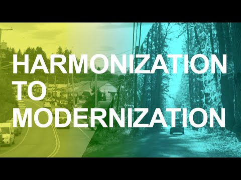 This video explains the process of harmonization to modernization
-

-

Harmonized Official Community Plan Bylaw 4270
-
Schedule A (558 KB) (pdf)
-
Schedule A - Appendix I Populations Housing Needs and Future Housing (412 KB) (pdf)
-
Schedule A - Appendix II CVRD Corporate Strategic Plan (765 KB) (pdf)
-
Schedule A - Appendix III Indicators Dashboard (975 KB) (pdf)
-
Schedule B Local Area Plan - Area A (386 KB) (pdf)
-
Schedule B Local Area Plan - Area B (871 KB) (pdf)
-
Schedule B Local Area Plan - Area C (836 KB) (pdf)
-
Schedule B Local Area Plan - Area D (3.69 MB) (pdf)
-
Schedule B Local Area Plan - Area E (1.65 MB) (pdf)
-
Schedule B Local Area Plan - Area F (1.5 MB) (pdf)
-
Schedule B Local Area Plan - Area G (4.57 MB) (pdf)
-
Schedule B Local Area Plan - Area H (1.63 MB) (pdf)
-
Schedule B Local Area Plan - Area I (435 KB) (pdf)
-
Schedule C Development Permit Areas (8.66 MB) (pdf)
-
Schedule D Agricultural Land Maps (34.9 MB) (pdf)
-
Schedule E Fire Protection Maps (20 MB) (pdf)
-
Schedule F Future Land Use Maps (14.2 MB) (pdf)
-
Schedule G Growth Management Concept Maps.pdf (20.7 MB) (pdf)
-
Schedule H Heritage Designation Maps (2.44 MB) (pdf)
-
Schedule I Foreshore and Major Creeks Maps (13.8 MB) (pdf)
-
Schedule J Sand and Gravel Deposits Maps (12.4 MB) (pdf)
-
Schedule L Land Use Designation Maps (45.3 MB) (pdf)
-
Schedule M Marine Area Maps (3.83 MB) (pdf)
-
Schedule N First Nations Maps (15.3 MB) (pdf)
-
Schedule O Floodplain and Dam Designations Maps (5.78 MB) (pdf)
-
Schedule P Terrestrial Parks Maps (2.56 MB) (pdf)
-
Schedule S Service Area Maps (39 MB) (pdf)
-
Schedule T Transportation and Major Roads Maps (28.9 MB) (pdf)
-
Schedule U Development Permit Area Maps (97.4 MB) (pdf)