FAQs
- What activities are permitted: Such as residential, business, agriculture, industry, and more
- How much you can build: The density or the number of buildings that can be put on one property
- How big buildings and structures can be: How tall and wide buildings and structures can be and how much of the site can be covered
- Where buildings or structures are located on the property: Setbacks or how close to your property line you can build
- If and how you can subdivide: How land is divided into separate parcels
including the shape and dimensions
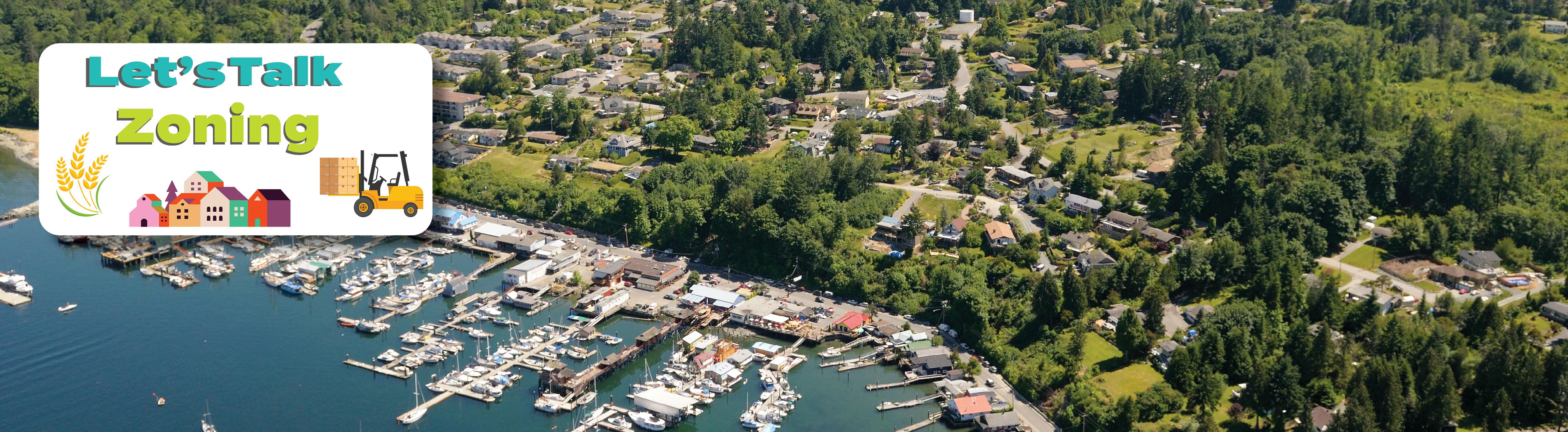
- The CVRD had ten separate Zoning Bylaws and seven separate Official Community Plans (OCPs). There were inconsistencies, inefficiencies, and unintended consequences.
- Electoral Area A – Mill Bay/Malahat
- Electoral Area C – Cobble Hill
- Electoral Area G – Saltair/Gulf Islands
- Electoral Area H – North Oyster/Diamond
What is a Zoning Bylaw?
In simplest terms, zoning is the regulation of land use and development. Zoning bylaws explains what can (and cannot) be done on a property, including things like:
Learn more about zoning by watching this video.
What's the history behind this work?
Here’s how it started:
Here’s what has happened:
2018 - the CVRD Board directed staff to harmonize and modernize both the Electoral Area Official Community Plans (OCPs) and the Zoning Bylaws.
2021 - a harmonized OCP for the electoral areas was adopted, consolidating seven OCPs into one.
2025 - the OCP was modernized and updated with refined land use designations and growth containment boundaries.
2026 - the Comprehensive Zoning Bylaw is being updated to align with the OCP and consolidate ten Zoning Bylaws into one.
Who will the CZB apply to?
If adopted, the CZB would apply to all lands in unincorporated areas of the CVRD, namely the nine Electoral Areas A though I. It does not apply to any lands in a municipality (incorporated areas). It also does not apply to marine areas: Electoral Area D – Cowichan Bay Marine area (as per Zoning Bylaw 1015 maps), or marine areas below the natural boundary of the Gulf of Georgia/Salish Sea in:
How can I find out what my zoning would be under the draft CZB?
Review the Draft CZB Document – this is the entire text of the draft Bylaw.
If you want assistance in finding out about which proposed CZB Zone would apply to your property, please contact Mike.Tippett@cvrd.bc.ca or phone 250-746-2602.
How can residents of CVRD electoral areas ask questions about the draft CZB?
You can email questions at any time to zoning@cvrd.bc.ca or send letters to:
CZB c/o Cowichan Valley Regional District
175 Ingram Street
Duncan BC V9L 1N8
Draft CZB - March 2026
- Electoral Area C, the R-3 zone permits up to 6 backyard hens
- Electoral Area D, six residential zones permit a maximum of 5 backyard hens.
- Roosters are not currently permitted in these zones.
- In zones that permit Limited Agriculture, there is no limit on the number of chickens permitted, including roosters. Chickens are not allowed to be permanently confined within buildings.
- In zones that permit Agriculture, larger-scale chicken farming is permitted, including roosters.
- In Agricultural (A-1 and A-2), Forestry (F-1), and Rural Residential 1 and 2 (RR-1 and RR-2) zones, all types of agriculture (including horses) are permitted.
- In Rural Residential 3 (RR-3) and River Corridor Residential (RC-1) zones, Limited Agriculture (including horses) is permitted. This includes most agricultural activities, except for mushroom growing indoors and the permanent confinement of poultry, livestock or other animals (such as chicken barns).
- In Residential 1 and 2 (R-1 and R-2) zones, horticulture, backyard hens and beekeeping are permitted.
- In Residential 3 (R-3) zone, backyard hens and beekeeping are permitted.
- Commercial zones: C-1, C-2, C-3, C-4
- Industrial zones: I-1, I-2, I-3, I4
- Institutional zone: P-2
- Outside the Agricultural Land Reserve (ALR): up to 111.5 m² (1,200 ft²), increased from 95 m² (1,022 ft²)
- Within the ALR: up to 90 m² (968 ft²), as required by the Agricultural Land Commission Act for parcels under 40 hectares.
- Municipal Ticket Information (MTI): maximum penalty of $3,000
- Bylaw Offence Notice (BON): maximum penalty of $500
- Offence Act (Provincial Court): maximum penalty of $50,000 (or $2,000 by default if not specified)
What does the draft CZB say about keeping chickens and why?
Chickens are addressed in the draft CZB in two ways:
Backyard Chickens in Residential Areas
The draft CZB would allow backyard hens on residential properties that are 2,000 m² or larger (about ½ acre). The number of hens permitted would vary based on lot size, with up to 6 chickens allowed.
Roosters would not be permitted in residential zones. These areas typically have smaller lots and homes in closer proximity, where rooster noise can be disruptive.
Under current zoning bylaws, backyard hens are only permitted in limited Residential zones within Electoral Areas C and D:
The draft CZB proposes to expand this permission to all Electoral Areas.
Chickens in Agricultural Zones or Zones that Permit Agriculture or Limited Agriculture
The draft CZB also permits chickens as part of agricultural use:
Limited Agriculture and Agriculture uses are both commonly permitted (though not in all cases across all zones and existing bylaws) within Rural Residential zones under both the current zoning bylaws and the draft CZB.
What does the draft CZB say about keeping horses and other farm animals?
In the draft CZB, keeping livestock, including horses, is considered part of agriculture. Agriculture is defined as “the use of land, buildings or structures for the growing, rearing, producing or harvesting of livestock or agricultural crops, and includes the processing on a parcel of the primary agricultural products harvested, reared, or produced on that parcel and the use and storage of associated farm machinery, implements and agricultural supplies”.
What is allowed in the draft CZB depends on the zoning of your property:
As stated in Question 1 above, under current zoning bylaws, backyard chickens are only permitted in limited residential zones in Electoral Areas C and D. The draft CZB proposes to expand this permission to all Electoral Areas.
Agricultural permissions become more limited in Residential and Rural Residential zones because typical farm activities are less suitable on smaller properties. The greatest restrictions are in the Residential 3 (R-3) zone, which generally includes smaller properties in suburban neighbourhoods.
Does the draft CZB limit how much of my property can be used for a vegetable garden?
No.
What does the draft CZB say about farm stands and why?
The draft CZB proposes to allow roadside stands on properties where the zoning permits agriculture, limited agriculture, horticulture, or backyard hen and beekeeping.
Roadside stands can sell items such as eggs, flowers and produce grown on the property, and other homemade products
My property is not in the ALR - will the draft CZB affect my farm status?
No. Farm status is determined by the BC Assessment Authority and is based upon actual land use, including meeting minimum income requirements from the sale of farm products.
Farm status is completely separate from zoning, so the draft CZB does not affect whether a property qualifies for farm status.
What does the draft CZB say about fence heights and why is there a height limit for front fences?
The fence height limits in the draft CZB are generally based on existing zoning bylaws.
Based on early feedback, the CVRD is reviewing the proposed fence regulations, particularly front yard fence heights and fencing for deer and elk.
What does the draft CZB say about occupying a recreational vehicle or park model trailer?
Provincial rules and Canadian Standards Association (CSA) approvals designed to ensure that year-round housing is safe and lawful. These standards limit permanent residential use to buildings such as houses, multi-unit buildings (like apartments and condos), manufactured homes, or modular homes.
Recreational vehicles (RVs) and park model trailers are certified under CSA “RV (Recreational Vehicle) Series” standards and are not approved or intended for full-time, year-round living.
However, the draft CZB, similar to many of the current zoning bylaws, does allow limited flexibility. If a building permit has been issued and a house is actively under construction, a property owner or builder may live on site in an RV during construction, subject to conditions in the General Regulations.
What does the draft CZB say about food trucks?
Right now, food trucks are generally not permitted under current CVRD zoning bylaws, except at one location in Electoral Area A (the Malahat Skywalk site).
The draft CZB proposes to allow food trucks in the following zones:
All food truck operations would be subject to conditions set out in Section 4.14 of the draft bylaw.
What does the draft CZB say about secondary suites?
The draft CZB reflects provincial requirements introduced in 2024 through Bill 44. These rules require all local governments to allow one attached secondary suite on any property that allows a single detached home as the primary use of the land.
When implementing Bill 44, the CVRD chose to go beyond the minimum provincial requirements. This included allowing detached suites in some zones, without minimum parcel size requirements, and in zones where uses other than single detached homes are permitted.
Under the draft CZB, the main proposed change is an increase to the maximum size of secondary suites:
What does the draft CZB say about docks?
The draft CZB updates regulations for docks to provide clearer direction to upland property owners.
The intent of the general regulation for docks is not to create new rules, but to align with and reinforce existing provincial requirements, which already regulate docks and other private moorage structures.
To review the Provincial General Permission for a Private Moorage Dock, please visit: https://www2.gov.bc.ca/gov/content/industry/crown-land-water/crown-land/crown-land-uses/residential-uses/private-moorage#General
What does the draft CZB say about non-compliance fines?
The current zoning bylaws were adopted many years ago, when provincial rules for bylaw enforcement were different and maximum penalties in the event of a Court conviction were lower.
The CVRD’s first approach is to achieve voluntary compliance. This means working with property owners to resolve issues without fines or legal action. Voluntary compliance does not involve fines or penalties.
If voluntary compliance cannot be reached, there are three enforcement options:
The type of enforcement used depends on the severity of the violation. MTIs and BONs are typically used for minor to moderate issues, while the Offence Act is used for more serious or ongoing contraventions.
The draft CZB includes language referencing the maximum $50,000 penalty under the Provincial Offence Act, which is already used in other CVRD bylaws (such as zoning, curbside collection, noxious weeds, and unsightly property).
This maximum penalty can only be imposed by a judge through a court process for very serious violations. It cannot be issued directly by the CVRD. Municipal tickets remain limited to a maximum of $3,000 under the MTI process.